In the past, boating heavily relied on traditional tools like compasses, paper charts, and sextants. Navigating vast and often unpredictable waters requires a high level of expertise and experience.
However, the advent of technology has revolutionized many aspects of our lives, and marine navigation is no exception. The emergence of marine navigation apps has significantly transformed the boating experience, making it safer, more efficient, and more enjoyable for both seasoned mariners and novice boaters alike.
In this blog, we’ll explore how the best marine navigation apps have brought about this transformation.
The Evolution of Marine Navigation
Before diving into the specifics of modern apps, it’s important to understand the historical context. Traditional navigation relied on physical charts, landmarks, and the stars.
Mariners had to be adept at interpreting these tools and making quick decisions based on ever-changing conditions. While effective, this method was time-consuming and prone to human error.
With the advent of GPS technology, marine navigation began to see significant improvements. GPS provided real-time location data, which was a game-changer for boaters. However, the true revolution came with the integration of GPS into mobile devices, giving rise to sophisticated marine navigation apps.
Key Features of the Best Marine Navigation Apps
1. Real-Time GPS Tracking
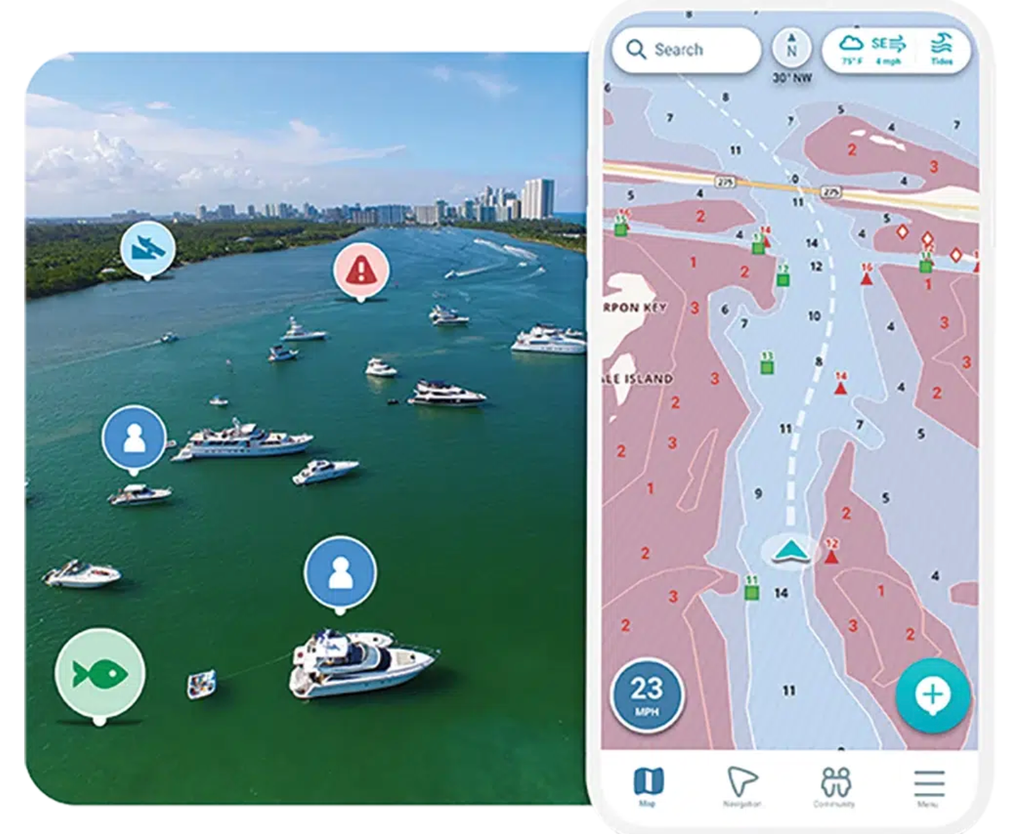
The cornerstone of any effective marine navigation app is real-time GPS tracking. This feature allows boaters to know their exact location at all times, which is crucial for safe navigation.
The best marine navigation apps offer highly accurate and up-to-date GPS data, ensuring that users can navigate confidently, even in challenging conditions.
2. Detailed Marine Charts
Access to detailed marine charts is another critical feature. These charts provide essential information about water depths, underwater hazards, and navigational aids like buoys and lighthouses.
Unlike traditional paper charts, digital charts in apps are interactive and constantly updated, ensuring that boaters always have the latest information at their fingertips.
3. Weather Forecasts and Alerts
Weather conditions can change rapidly on the water, and being caught in a storm or rough seas can be dangerous. The best marine navigation apps include integrated weather forecasting and alerts.
Users can receive real-time updates on wind speed, wave height, and other critical weather parameters, helping them make informed decisions about when and where to sail.
4. Route Planning and Optimization
Efficient route planning is essential for saving time and fuel. Advanced marine navigation apps allow users to plot routes based on various factors, including distance, current, and tide conditions.
Some apps even offer automatic route optimization, suggesting the safest and most efficient paths to reach a destination.
5. Community Features and Social Sharing
Boating is often a social activity, and many modern apps recognize this by incorporating community features. Users can share their routes, favorite spots, and experiences with other boaters.
These social features not only enhance the sense of community but also provide valuable insights and recommendations from fellow mariners.
6. Offline Functionality
Connectivity can be unreliable at sea, so offline functionality is a must-have for any marine navigation app. The best apps allow users to download maps and charts for offline use, ensuring that navigation tools remain accessible even in remote areas with no internet connection.
How do These Features Transform Boating Experiences?
1. Enhanced Safety
Safety is paramount on the water, and the best marine navigation apps significantly enhance safety in several ways. Real-time GPS tracking ensures that boaters always know their precise location, reducing the risk of getting lost.
Detailed charts and hazard alerts help avoid dangerous areas, while weather forecasts and alerts enable mariners to avoid adverse conditions. Together, these features make boating safer and give users peace of mind.
2. Improved Efficiency
Time and fuel are valuable resources for any boater. With advanced route planning and optimization features, marine navigation apps help users find the most efficient routes, saving both time and fuel. This not only reduces operational costs but also minimizes the environmental impact of boating.
3. Increased Accessibility
Marine navigation apps have made boating more accessible to a wider audience. Novice boaters, who might be intimidated by traditional navigation methods, can now navigate with confidence using intuitive app interfaces.
The availability of detailed charts, route planning tools, and real-time updates levels the playing field, allowing more people to enjoy boating.
4. Enhanced Enjoyment
Ultimately, boating is about enjoyment and relaxation. The best marine navigation apps enhance this experience by eliminating many of the stresses associated with navigation.
Boaters can focus more on the beauty of the surroundings and the thrill of being on the water, knowing that their app is handling the complexities of navigation.
Final Words
The best marine navigation apps have undeniably transformed the boating experience, making it safer, more efficient, and more enjoyable.
These apps provide invaluable tools for modern mariners by harnessing the power of GPS, detailed charts, real-time weather updates, and advanced route planning.
Whether you’re a seasoned sailor or a weekend boater, embracing the latest in marine navigation technology can enhance your time on the water and help you navigate confidently.


